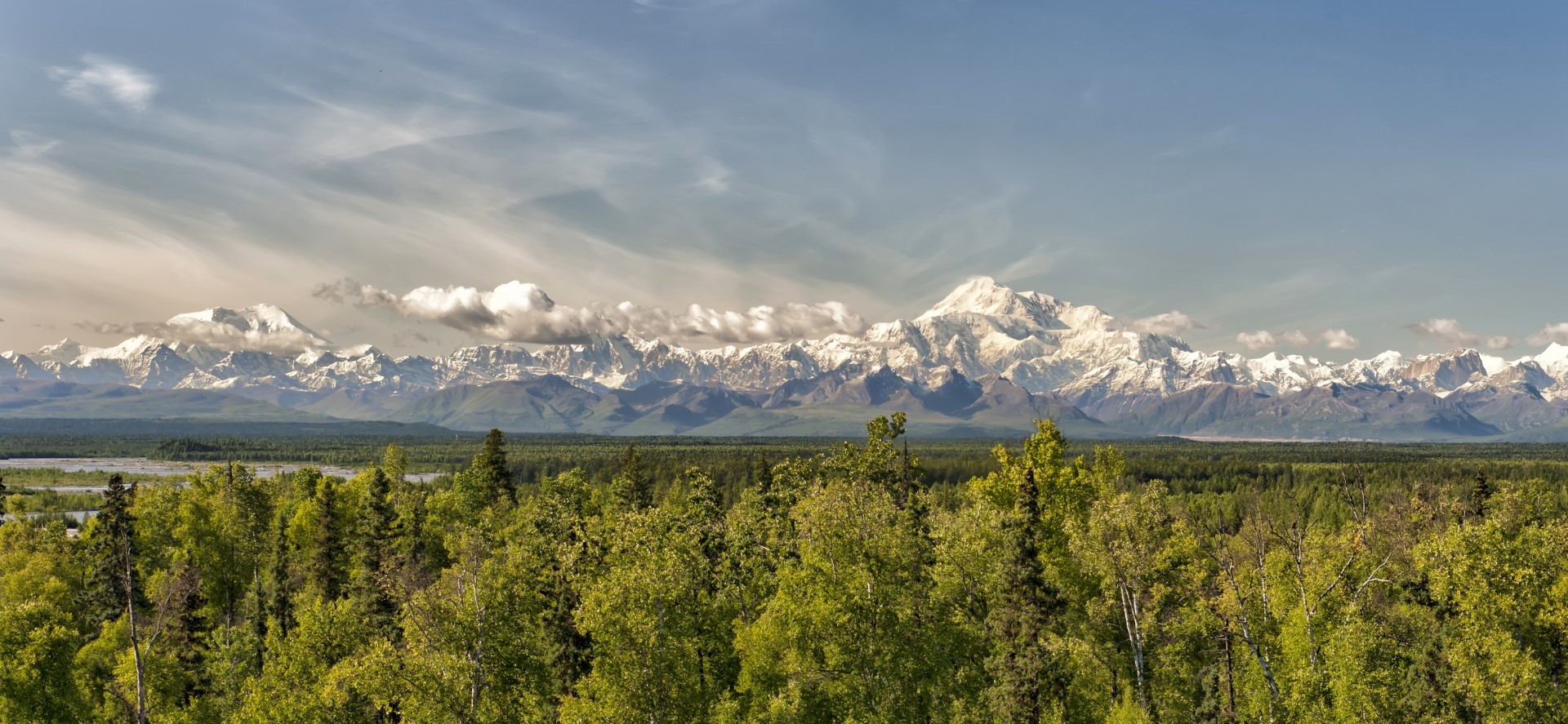
Many have heard about the state highpoints quest and contemplated it over a beverage or two. An experienced mountaineer or even someone who is fit and very determined could do most of the peaks. You could even get a little help, like on Rainier where climbers often use a guide service. Denali in Alaska however, is in a whole ‘nother league. Because of the high elevation (20,310 feet), extreme weather exposure, and long duration (17-21 days), Denali is considered a much more serious undertaking.
 Denali, the hardest of them all
Highpointing is the term for seeking to reach the highest points in specified regions. The most recognized and prestigious list is probably the Seven Summits, or the highest points on each of the seven continents (Denali included). The state high points is another recognized list and even has a club, the Highpointers Club, which tracks those who have completed all 50 (nearly 300 people). They also track those who complete the 48 in the contiguous United States (over 500).
As you can see, while many people have traveled to each of the 50 states, very few have been to the summit of each one. Even within the lower 48, there is a wide discrepancy between the amount of effort involved in reaching these summits.
Ranking them by difficulty:
- Denali (AK)
- Rainier (WA), Gannett (WY), Granite (MT)
- Hood (OR), Borah (ID)
- Whitney (CA), Kings (UT)
- Elbert (CO), Wheeler (NM), Boundary (NV), Humphreys (AZ)
- Guadalupe (TX), Katahdin (ME), Marcy (NY)
See the full list below.
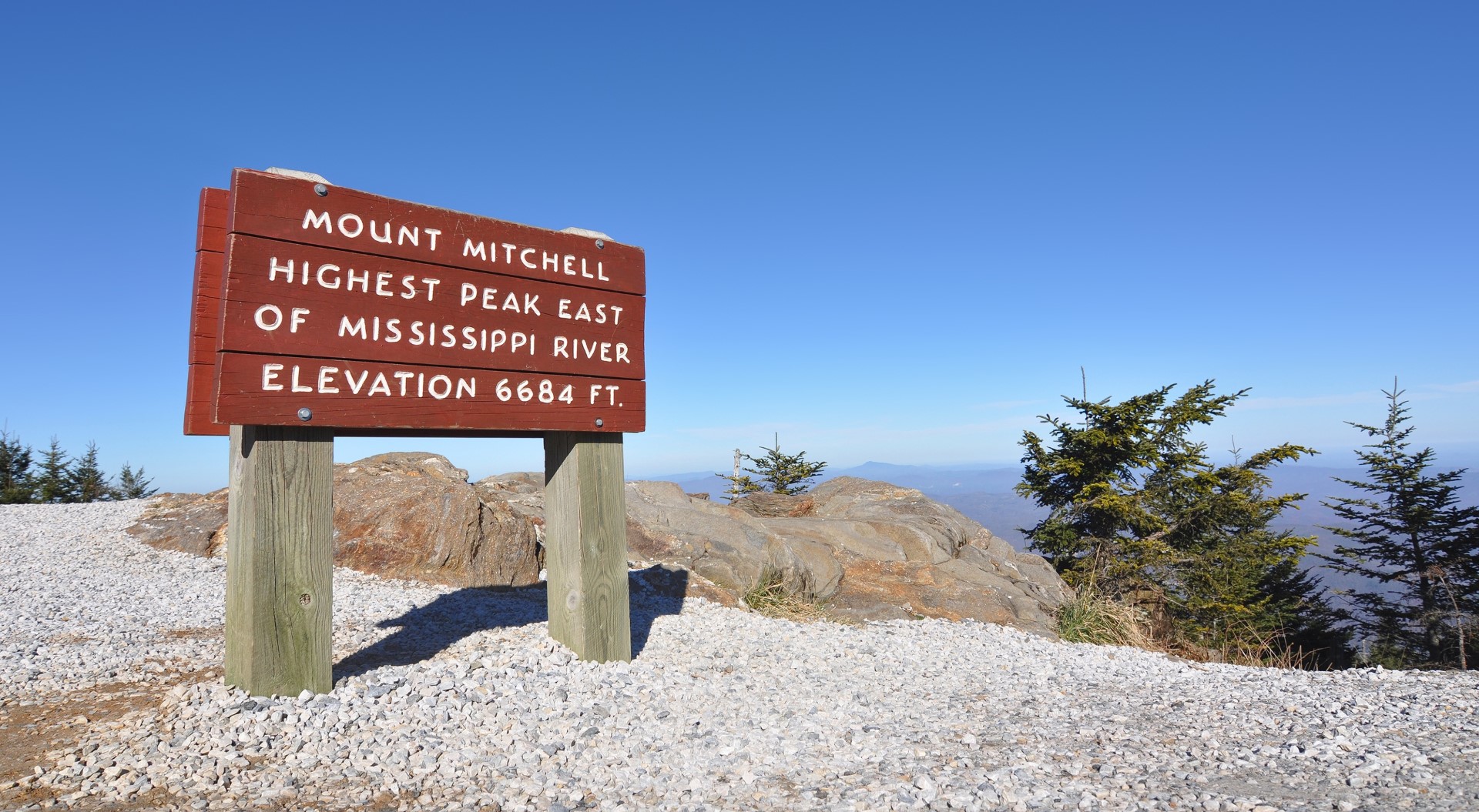
The rest are not considered difficult. Most are relatively easy day-hikes, walks, or even drives. About 20 of them have roads that lead to a walk of less than a half-mile. Some of those that can be driven, Mt. Washington (NH) and Mt. Mitchell (NC) for example, have optional hiking trails that would make earning the summit much more rewarding. Mauna Kea in Hawaii has a road to the top, but the high elevation makes the short hike at the end still feel huge (it’s almost a Fourteener). Several of the “summits” aren’t mountains or peaks at all. Sunflower (KS) is in the middle of a field, and Ebright Azimuth (DE) is along a sidewalk, and the lowest high point in America, Britton Hill (FL), is in a flat county park.
The high points in Illinois and Kentucky are located on private property and require permission from the land owner to visit, not to mention that they have restricted “visiting hours.”
 Mt. Mitchell, high by east coast standards
Below is a list of the 50 state high points from highest to lowest, except that Point Reno in Washington, D.C. has been added to the end for extra credit. See the map above to locate the high points by state.
Mountains on this map
| Mountain |
Elevation |
| Denali – Mt McKinley (State High Point) |
20,310 ft (6,190 m) |
| Mount Whitney (State High Point) |
14,497 ft (4,419 m) |
| Mount Elbert (State High Point) |
14,433 ft (4,399 m) |
| Mount Rainier (State High Point) |
14,411 ft (4,392 m) |
| Gannett Peak (State High Point) |
13,804 ft (4,207 m) |
| Mauna Kea (State High Point) |
13,803 ft (4,207 m) |
| Kings Peak (State High Point) |
13,528 ft (4,123 m) |
| Wheeler Peak (State High Point) |
13,161 ft (4,011 m) |
| Boundary Peak (State High Point) |
13,140 ft (4,005 m) |
| Granite Peak (State High Point) |
12,799 ft (3,901 m) |
| Borah Peak (State High Point) |
12,662 ft (3,859 m) |
| Humphreys Peak (State High Point) |
12,633 ft (3,851 m) |
| Mount Hood (State High Point) |
11,239 ft (3,426 m) |
| Guadalupe Peak (State High Point) |
8,749 ft (2,667 m) |
| Black Elk Peak – Harney Peak (State High Point) |
7,242 ft (2,207 m) |
| Mount Mitchell (State High Point) |
6,684 ft (2,037 m) |
| Clingmans Dome (State High Point) |
6,643 ft (2,025 m) |
| Mount Washington (State High Point) |
6,288 ft (1,917 m) |
| Mount Rogers (State High Point) |
5,729 ft (1,746 m) |
| Panorama Point (State High Point) |
5,426 ft (1,654 m) |
| Mount Marcy (State High Point) |
5,344 ft (1,629 m) |
| Mount Katahdin (State High Point) |
5,268 ft (1,606 m) |
| Black Mesa (State High Point) |
4,973 ft (1,516 m) |
| Spruce Knob (State High Point) |
4,861 ft (1,482 m) |
| Brasstown Bald (State High Point) |
4,784 ft (1,458 m) |
| Mount Mansfield (State High Point) |
4,393 ft (1,339 m) |
| Black Mountain (State High Point) |
4,139 ft (1,262 m) |
| Mount Sunflower (State High Point) |
4,039 ft (1,231 m) |
| Sassafras Mountain (State High Point) |
3,554 ft (1,083 m) |
| White Butte (State High Point) |
3,506 ft (1,069 m) |
| Mount Greylock (State High Point) |
3,487 ft (1,063 m) |
| Backbone Mountain (State High Point) |
3,360 ft (1,024 m) |
| Mount Davis (State High Point) |
3,213 ft (979 m) |
| Magazine Mountain (State High Point) |
2,753 ft (839 m) |
| Cheaha Mountain (State High Point) |
2,413 ft (735 m) |
| Mount Frissell South Slope (State High Point) |
2,375 ft (724 m) |
| Eagle Mountain (State High Point) |
2,301 ft (701 m) |
| Mount Arvon (State High Point) |
1,978 ft (603 m) |
| Timms Hill (State High Point) |
1,951 ft (595 m) |
| High Point (Highest Point in State) |
1,803 ft (550 m) |
| Taum Sauk Mountain (State High Point) |
1,772 ft (540 m) |
| Hawkeye Point (State High Point) |
1,670 ft (509 m) |
| Campbell Hill (State High Point) |
1,549 ft (472 m) |
| Hoosier Hill (State High Point) |
1,257 ft (383 m) |
| Charles Mound (State High Point) |
1,235 ft (376 m) |
| Jerimoth Hill (State High Point) |
812 ft (247 m) |
| Woodall Mountain (State High Point) |
806 ft (246 m) |
| Driskill Mountain (State High Point) |
535 ft (163 m) |
| Ebright Azimuth (State High Point) |
441 ft (134 m) |
| Britton Hill (State High Point) |
345 ft (105 m) |
| Point Reno (DC Highest Point) |
409 ft (125 m) |
 Denali, the hardest of them all
  Mt. Mitchell, high by east coast standards